Course overview.
Participants will gain hands-on exposure to modern geospatial OSINT tools and methodologies, from automated change detection and demographic mapping to supply chain visibility and infrastructure analysis. Using real-world business scenarios, the course demonstrates how geospatial data can be applied to assess competitor sites, map target markets, monitor resource availability, and guide high-stakes procurement decisions. The practical emphasis ensures that delegates leave with both conceptual understanding and operational tradecraft they can implement immediately in their organisation.
Who it's for.
This programme is ideal for business leaders, procurement specialists, intelligence analysts, risk managers, and strategic planners who need to evaluate markets, assess potential sites, or monitor competitor activity with greater precision. It is also suitable for professionals in real estate, logistics, finance, and consulting who want to enrich their decision-making with location-based insights. No prior experience in GIS or satellite analysis is required, although familiarity with basic business intelligence concepts is beneficial.
What you'll learn.
Module 1: Remote Sensing & Imagery for Market Analysis
This module introduces participants to the fundamentals of satellite imagery, aerial photography, and crowd-sourced geospatial data. Delegates learn how to interpret visual and spectral signatures in imagery to detect infrastructure expansion, economic activity, and land-use patterns. Practical exercises cover change detection, monitoring construction projects, and tracking logistical networks, providing the technical foundation for imagery-based business intelligence.
Module 2: Geospatial Correlation & Competitor Intelligence
Here, the focus shifts to integrating multiple geospatial layers to uncover relationships between assets, competitors, and markets. Participants will use mapping platforms, demographic datasets, and location intelligence APIs to identify customer clusters, competitor facilities, and supply chain dependencies. The module demonstrates how geospatial correlation can support site selection, market entry, and competitive risk assessments.
Module 3: Applied Geospatial Risk & Opportunity Assessment
The final module applies geospatial OSINT to practical business challenges. Participants explore how to evaluate infrastructure accessibility, environmental constraints, and geopolitical risks using open-source mapping and data feeds. Case studies include assessing the viability of new retail sites, identifying high-growth urban zones, and evaluating risks in emerging markets. By the end, delegates will be able to transform raw geospatial data into structured intelligence for decision-making.
What you'll leave with.
By the end of the day you'll be able to:
- Interpret satellite and aerial imagery for business insight
- Detect change over time at sites of interest
- Layer demographic, transport and competitor data on maps
- Compare sites using catchments and coverage gaps
- Assess location risks such as flooding, access and infrastructure
Before you book: No GIS or imagery experience needed; basic business intelligence concepts help. Not sure it's the right level? Take the one-minute self-check.
Pairs well with:
See the market from above.
Location data reveals what spreadsheets can't. Here's how the day turns maps and imagery into business decisions. Select any stage to jump to it.
Is this course right for you?
Five quick questions, about a minute. You'll get an honest read on whether Geospatial OSINT fits where you are now, and which parts of the course will help you most.
This course is fully fundable through ReACT+.
If you've been made redundant or are facing redundancy in Wales, the Welsh Government's ReACT+ scheme can fund up to £1,500 toward this course — plus childcare, travel and accommodation expenses. We'll handle the application.
Benefits of Attending This Course
Develop practical geospatial OSINT and GEOINT skills to support market analysis, site selection and strategic decision-making. Learn how to combine location-based data with open-source intelligence to identify opportunities, reduce risk and gain deeper business insight.
Ascent Training Wales · Bridgend.
Our conference room is purpose-built for effective training — bright, modern, and fully equipped for workshops, seminars and accredited sessions.
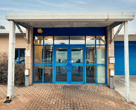
Llynfi Enterprise CentreHeol Ty Gwyn Industrial Estate
Maesteg, Bridgend, CF34 0BQ
Use Geospatial Intelligence for Better Decisions
Understand GEOINT Techniques
Learn how geospatial intelligence and open-source data can be used to analyse locations, environments and market opportunities.
Improve Site Intelligence
Develop practical skills for assessing locations, identifying patterns and supporting better strategic and commercial decisions.
Gain Competitive Insight
Use publicly available geospatial information to understand markets, assess risks and uncover valuable business intelligence.
What people get wrong.
Three things we hear before almost every Geospatial OSINT course, and what's actually true.
Satellite imagery is only for governments.
Reality
Free and low-cost imagery is widely available, and commercial imagery is affordable for many business decisions.
You need GIS software to start.
Reality
Many insights come from free web-based tools. GIS helps later, once you know what you're looking for.
A map shows the truth.
Reality
Imagery can be dated and data incomplete. Always check the capture date and corroborate with other sources.
Common questions.
Quick answers to what most people ask before booking. Still need help? Get in touch.
How long is the course and where is it delivered?
How much does it cost and what's included?
When is the next date available?
Is this course eligible for ReACT+ funding?
Can you deliver this course in-house for our team?
Do I need GIS experience?
Is geospatial OSINT legal?
Which sectors use this?
From the classroom.
Our Bridgend venue is purpose-built for working learning — bright, modern, configurable for cohorts of four to twelve, with quality AV throughout and free parking right outside.

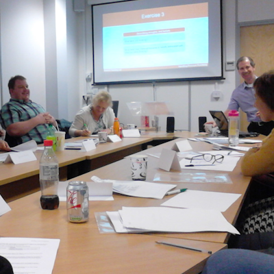


Llynfi Enterprise Centre · Bridgend · More about our venue →
See the bigger picture.
Location-based intelligence can reveal insights that traditional research can miss. This practical course in Cardiff introduces the use of geospatial open-source intelligence (OSINT) and GEOINT to research markets, locations, sites and surrounding environments. Learn how maps, satellite imagery, publicly available information and spatial data can be brought together to support better-informed commercial and strategic decisions.
Understand geospatial intelligence
Explore the principles of OSINT and GEOINT and understand how location, geography and publicly available information can provide valuable business intelligence.
Research markets and locations
Learn how geospatial information can support market research, competitor analysis, property assessment, site selection and understanding local environments.
Work with maps and imagery
Develop practical skills for interpreting maps, satellite imagery and other geographic information to identify patterns, opportunities and potential risks.
Turn information into insight
Learn how to combine different sources of publicly available information, assess reliability and present findings clearly to support commercial and strategic decision-making.
Apply skills in Wales
Develop practical intelligence skills that can support organisations across Cardiff and Wales in areas such as property, development, infrastructure, planning, investment, business research and site intelligence.
More in Management.
Courses that pair well with Geospatial OSINT for Market & Site Intelligence Course, or that your team often takes as a sequence.


Ready when you are.
Book Geospatial OSINT for Market & Site Intelligence Course for £275 a seat, or send us a brief and we'll come back with a tailored in-house quote for your team within two working days.